
Volcanological Research
Italy: Mapping Mount Etna
40 km
average distance

40 min
average flight time
2 kg
average payload
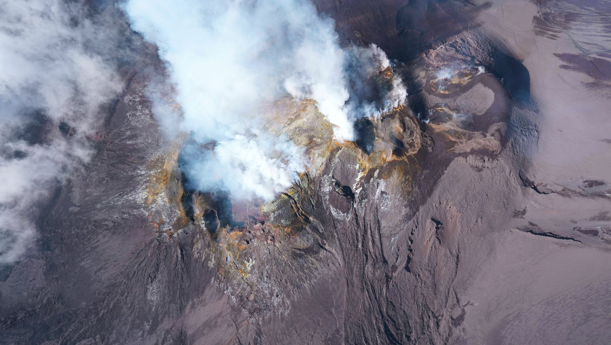
Photo © GEOMAR Helmholtz Centre for Ocean Research Kiel
Challenge
Challenge
Challenge
Challenge
A crucial tool for risk-mitigation in volcanic areas are up-to-date hazard maps that are created based on topographical changes at the volcano (e.g. through deformation or lava flow emplacement). Creating such maps is, however, tedious and often dangerous.
The remote island of Pentecost is one of 83 islands in the South Pacific that make up the nation of Vanuatu. The 60 km long island is made up predominantly of mountainous terrain covered in dense jungle. In many cases, the islanders don’t have access to roads, electricity or permanent healthcare facilities.
Providing access to vaccines in the most remote communities involves nurses travelling from health centers, sometimes having to hike for several hours or days, or travel by boat around the island. Even short distances can take long and costly hours in which the heat-sensitive medical supplies are exposed to the tropical heat and arduous travel conditions.
A crucial tool for risk-mitigation in volcanic areas are up-to-date hazard maps that are created based on topographical changes at the volcano (e.g. through deformation or lava flow emplacement). Creating such maps is, however, tedious and often dangerous.
A crucial tool for risk-mitigation in volcanic areas are up-to-date hazard maps that are created based on topographical changes at the volcano (e.g. through deformation or lava flow emplacement). Creating such maps is, however, tedious and often dangerous.
Solution
Solution
Solution
GEOMAR Helmholtz Centre for Ocean Research Kiel uses Wingcopters for frequent mapping campaigns that allow to quantify changes and obtain the topographic maps that serve as basis for the simulation and forecasting of future events.
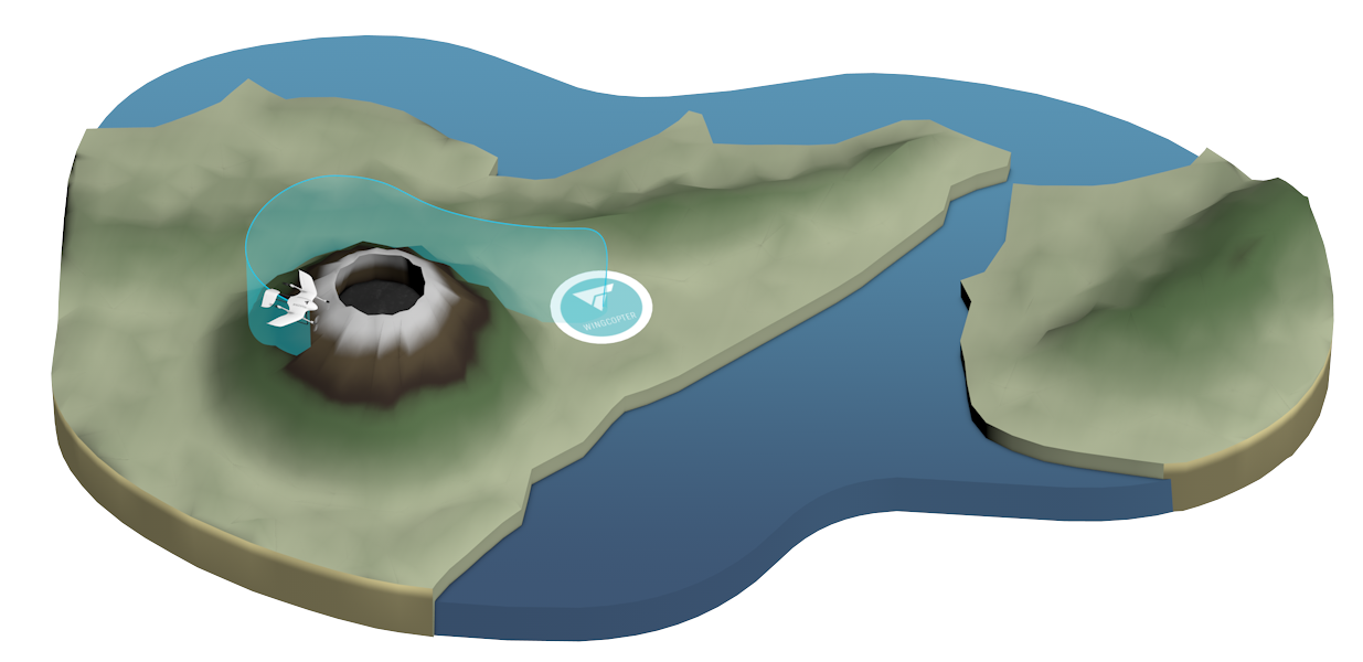
A Wingcopter, for example, was used by GEOMAR, in collaboration with INGV Catania, to map Mount Etna in Sicily, the highest active volcano in Europe. To be able to map the volcano’s summit at 3,323 meters, the Wingcopter had to climb to an altitude of 3,500 meters.
GEOMAR Helmholtz Centre for Ocean Research Kiel uses Wingcopters for frequent mapping campaigns that allow to quantify changes and obtain the topographic maps that serve as basis for the simulation and forecasting of future events.
A Wingcopter, for example, was used by GEOMAR, in collaboration with INGV Catania, to map Mount Etna in Sicily, the highest active volcano in Europe. To be able to map the volcano’s summit at 3,323 meters, the Wingcopter had to climb to an altitude of 3,500 meters.


Outcome
Outcome
Outcome
Unmanned aerial vehicles such as the Wingcopter represent a cheap, fast and safe method to map and monitor volcanoes even during eruptions without endangering those performing the surveillance
Unmanned aerial vehicles such as the Wingcopter represent a cheap, fast and safe method to map and monitor volcanoes even during eruptions without endangering those performing the surveillance
Unmanned aerial vehicles such as the Wingcopter represent a cheap, fast and safe method to map and monitor volcanoes even during eruptions without endangering those performing the surveillance
"Hybrid-drones like Wingcopters are the ideal tool to map volcanoes and have provided a powerful step forward for survey efficiency. We are especially impressed with their high payload as well as their resilience to high altitudes and winds, which are always present on stratovolcanoes like Mt. Etna."
Dr. Karen Strehlow
GEOMAR Helmholtz Centre for Ocean Research Kiel
Impressions


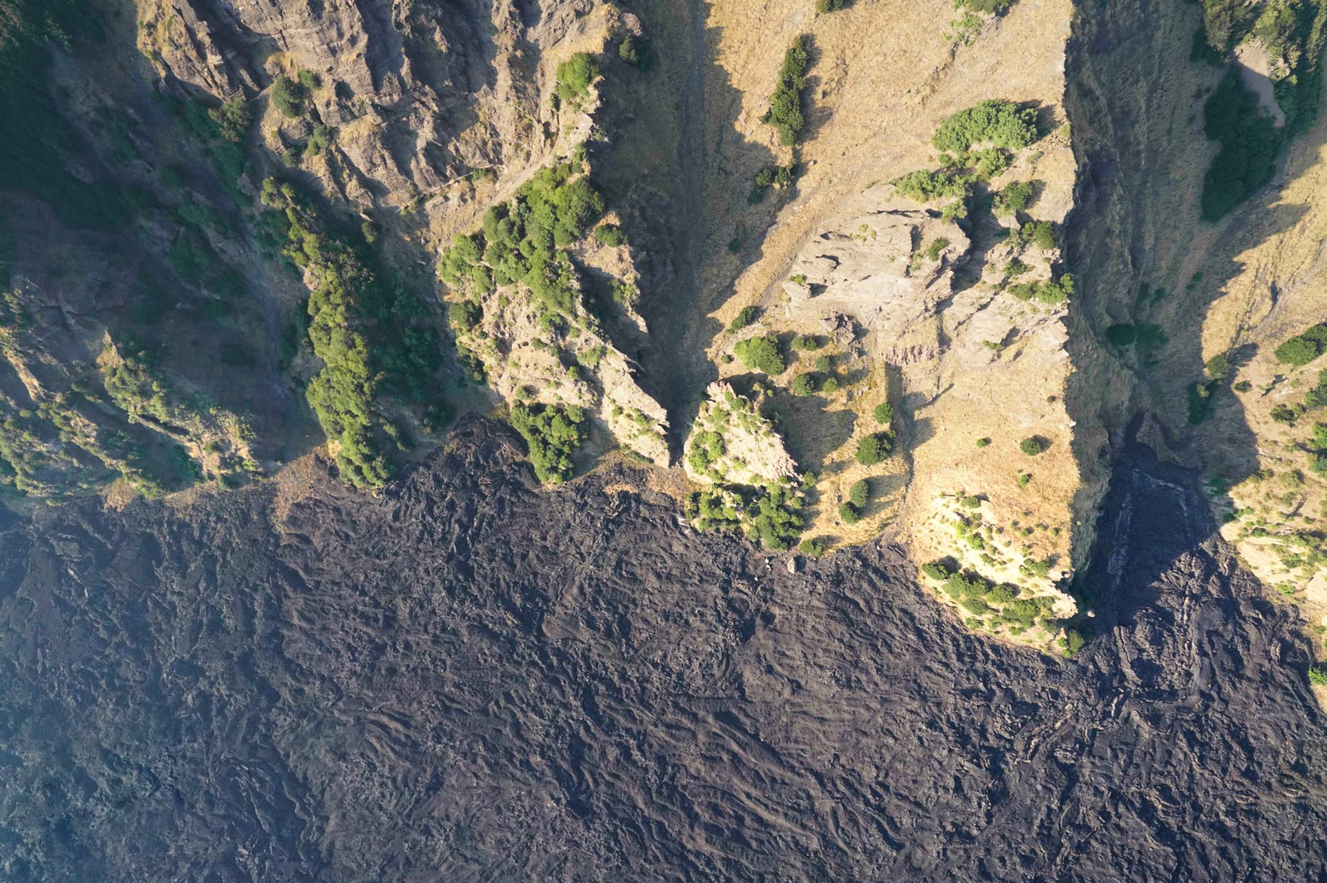
Photo © GEOMAR Helmholtz Centre for Ocean Research Kiel
Connect with us and discover what our drone solutions can do for you
Stay up-to-date
Sign up for our newsletter to receive the latest news about our product development, interesting projects, new strategic partners, company milestones etc.
